This website uses cookies so that we can provide you with the best user experience possible. Cookie information is stored in your browser and performs functions such as recognising you when you return to our website and helping our team to understand which sections of the website you find most interesting and useful.
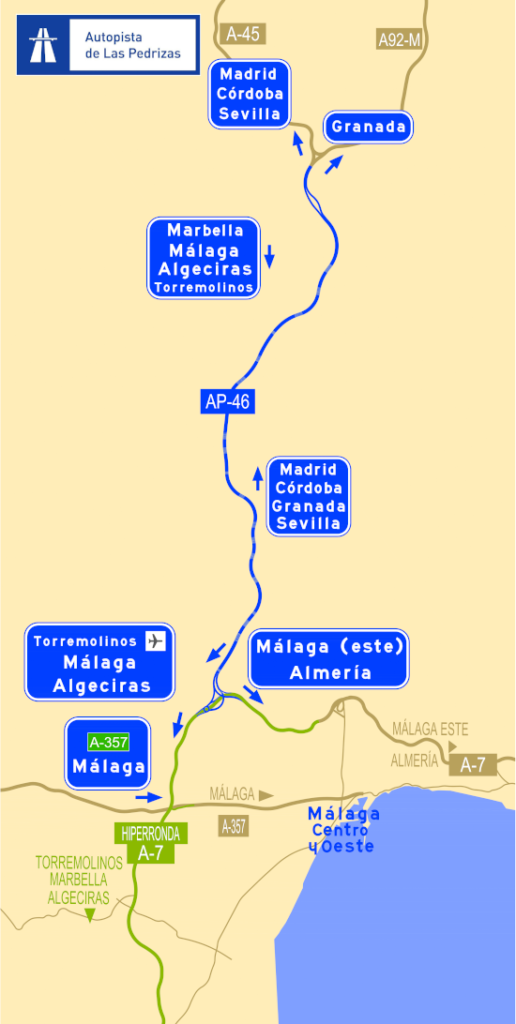
AP46 Map
The motorway starts its North-South route at a point close to what is currently the intersection of the A-45 (Cordoba/A-92 – Málaga) motorways and the A-92M motorway (Cuesta de La Palma – Alto de las Pedrizas). This area is close to the town of Villanueva de Cauche, which pertains to the municipality of Antequera, and is the location of the initial entry point onto the motorway (entry point A-1, at K.P. 141.0 of the A-45).
The road initially lies to the East of the A-45, which it crosses 5 km further on at K.P. 146.0 to the North of Casabermeja, and then carries on to the West of the A-45 until it reaches the Northwest area of Málaga (North of Puerto de la Torre) and links up with Málaga’s second West Ring Road via a second intersection (A-2).
The intersection of the AP-46 with the second West Ring Road (intersection A-2), allows Eastbound traffic to access Málaga from the North. The connections between Málaga’s second West Ring Road and the C-3310 to the Northwest, the A-357 (Campanillas/Cártama) to the West, Valle de Guadalhorce to the Southwest (the Airport, Churriana, Alhaurín/Coín and Torremolinos), and the AP-7 (Costa del Sol), greatly improve the flow of incoming traffic towards the Ring Road.


